
Allhallows
-

The Water Tank
After the First World War, the Kent and London County Councils planned to redevelop Allhallows, to rival that of Blackpool. According to newspaper reports at the time, the amusement park was to be four times bigger than the one at the northern resort. There would also be a zoo, yachting centre and a lido with artificial waves, the first such pool in Europe. The development, which would have covered more than two and a half square miles, had plans to include a holiday camp, restaurants, theatres and cinemas. Unfortunately, due primarily to the outbreak of the Second World War, the councils eventually abandoned the project.
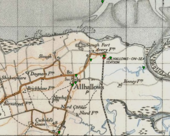
In the light of this, Allhallows-on-Sea railway station, situated at the end of Avery Way on the south side, opened on 16 May 1932, in preparation for thousands of expected visitors to the resort. In the first year of opening, the line carried 6500 passengers, much to the encouragement of the railway, who proceeded with improvements to the station. Sadly, that level of demand was never to be repeated, and the station closed in 1961. The site is now a residential Park Home Estate known as Kingsmead Park Allhallows.
During the war the line was well used with the oil terminal being adapted as the base for PLUTO (Pipeline under the Ocean) supplying the allied forces in Europe.
Although the station has been demolished, the water tank on the end of the platform was retained within the estate and is now a listed structure. It has been restored and is well maintained.
Photo by Peter Hatton
General Manager, Kingsmead Park
-

Slough Fort
Slough Fort is a small artillery fort that was built at Allhallows-on-Seain the north of the Hoo Peninsulain Kent. Constructed in 1867, the D-shaped fort was intended to guard a vulnerable stretch of the River Thamesagainst possible enemy landings during a period of tension with France, and also to prevent an enemy landing at the only accessible point for the purpose of attacking Chatham Dockyardfrom the north".
Main Entrance of Slough Fort
Slough Fort is well-preserved and still substantially intact, though it has suffered some damage over the years (notably the loss of the outermost gun position of the left wing battery) and is surrounded on three sides by the caravans of the Allhallows Leisure Park.
The main body of the fort is not accessible to the public, but Bourne Leisure, the owners of the adjoining Allhallows Leisure Park, have funded a partial restoration.
The wing batteries have been cleared of thousands of tons of accumulated debris. A walking trail linking them has been laid out and interpretative signs have been installed for the benefit of visitors to show how the fort once appeared and how it functioned when it was in use. Since the 1960s, it has been used as stables for the camp. The Slough Fort Preservation Trust is working to repair the fort and increase public access.
-

Decoy Fire Structures
Situated in the Allhallows Marshes are the well preserved remains of a Second World War QF P-Series oil bombing decoy. This site was constructed to draw enemy raids from the extensive oil storage depots 2 km to the south on the Isle of Grain.
Oil QF decoys were designed to burn large quantities of fuel oil in a variety of brick or clay lined pools and channels variously shaped to simulate burning fuel storage tanks and installations targeted by bombs when seen from the air.
Aerial photographs taken in September 2013 and March 2014 suggests that all the main structures of the Allhallows decoy, including oil pools and associated structures and the remote control buildings are still extant in varying states of preservation.
On the edge of a few farmed fields and the path to Binney Farm is a Second World War ‘night shelter’, a reinforced unit of two rooms and part of an ‘Oil QF’ decoy site. The square block at the top on the right is an escape hatch.
About 25m from the night-shelter, a series of concrete supports once held a large oil tank, fuel for the decoy fires.
-

Yantlet Creek
The Romans used the nearby Yantlet creek for trade, although due to silting, its viability as a trading route diminished.
Yantlet Creek is the creek draining into the River Thames that separated the Isle of Grain from the Hoo peninsula. It once connected the River Medway with the River Thames and made the Isle of Grain a true island. The creek silted up and now drains the area of The Isle of Grain and Allhallows Marshes. It was the preferred way for Medway boatmen to reach the Thames, being shorter and less hazardous than passing by Queenborough.
Prior to the twentieth century, the creek was used for salt workings, fishing and oyster beds. Flounders, eels, herrings and lobster were all caught in the creek.
The old Coast Guard cottage, Observer Post 1/B1, as was.
In the field to the left lies an old Nuclear Bomb Observation Bunker, a relic from the Cold War days.
The bunker is inaccessible as the entrance shaft has been filled with concrete rubble.
Yanlet Creek Coastguard Station is shown as being housed in an unnamed boat on the 1st
Edition OS 6 inch map. There are concrete blocks and modern planks remains of a building visible beside what is recorded as an old enclosure; these may be the remains of the Coastguard station.
Also, the remains of an old tarmacadam road and a concrete gate post are marked on the OS 2nd edition map
This feature is recorded in the English Heritage Historic Area Assessment for Allhallows Parish. The report states: "The remoteness of Avery and its proximity to the Thames and the Yantlet Creek provided ideal conditions for smuggling. This led to the establishment of a coastguard station here presumably occupying a moored hulk on the riverside.
This was swept away in 1897 and the station was re-established in Avery, presumably in the building now known as Coastguard Cottage to the north of Avery House, which also housed a port signal station."
-

Allhallows Church
All Saints Church in Stoke Road Allhallows is part of the Parish of “High Halstow with Allhallows & St. Mary Hoo” which is a combination of three ancient parishes each dating back almost a 1000 years. The church is Sister Church to St. Margaret’s Church, High Halstow
The church is dedicated to All Saints, commonly called Allhallows. Our church is both a place of worship and a community hub.
The Normans built it in the 12th century, and was rebuilt in 1252 as a Chapel-of-Ease to St. Werburgh until 1327 when the Bishop of Rochester made it a parish in its own right.
It is a Grade I listed building of architectural and historic importance. It is the only Grade I listed building on the Hoo Peninsula and is built of flint and stone with a lead roof. There have been alterations and additions during the Centuries, all using the same Kentish Ragstone, indications of which can still be seen today.
It has a west tower, north and south porches to the nave, and a chancel. The earliest part is the west end of the nave, followed by the south arcade. The north arcade dates from the early 13th century, while the chancel arch and screen are 14th century.
-

The London Stone
Sited at the mouth of Yantlet Creek is the London Stone, erected in 1856 by the Victorians to mark the eastern boundary of the City of London’s jurisdiction over the River Thames. The Stone is one of several which asserted the City’s ownership of the Thames and the river’s valuable fisheries and tolls.
The stone’s purpose was short-lived, with the City losing control to the Crown in 1857 under The Thames Conservancy Act.
The London Stone can be reached at low tide if you’re prepared to risk mud, water and trespass. It replaced a much earlier marker of 1285
-

Allhallows & the Battle of Britain
Allhallows has always been a little known seaside resort, then situated at the end of the southern railway’s branch line from Gravesend and seemingly at the end of the road from the middle of nowhere.
However, Allhallows was very much a place of strategic importance in the summer of 1940, as indeed was the rest of the Hoo Peninsula, and the fact that the Luftwaffe photographed the village and correspondingly prepared a target information sheet on Allhallows, shows the degree of importance they evidently attached to the place.
JUNE 1940
Residual defences from the Napoleonic era were brought into play at this crucial time too. Built in 1867, Slough Fort at Allhallows, which still stands today on the Kent side of the Thames estuary, is a fine example of this.
In late 1939, the British army had again requisitioned Slough Fort as part of the coastal defence programme. There were four coastal defence guns sited facing north, utilising the First World War 3 inch quick firing guns and a pair of heavy 9.2-inch breech-loaders had once stood. In May of 1940, the men of 159 battery, 53 (City of London) heavy anti-aircraft regiment of the Royal Artillery also moved in, though their four modern 4.5-inch, quick firing guns were positioned about a quarter of a mile away from the fort in what is now Avery way, on a purpose built emplacement facing east.
On 5th September at 15:10 hours, the Luftwaffe was over the Hoo Peninsula again. 166 battery 53 (City of London) heavy anti-aircraft regiment, observed twelve Heinkels north of their site, position S9, near Chattenden, flying east at an estimated height of 19,000 ft., but sadly out of the range of their guns. The Thames Haven oil storage tanks on the Essex bank of the Thames, always a good target, were the bombers’ objective.
Their counterparts of 159 Battery based at Allhallows, logged that at 15:12 hours their four 4.5 inch guns engaged the same twelve Heinkels north-west of their position. Upon engagement by 159 Battery, the raiders quickly climbed from 17,500 feet to 21,000 in an attempt to avoid the intense barrage being put up by the Essex gunners as well as those at Allhallows. However, the twelve German bombers made only a fleeting attack and were soon clear of Thames Haven and on their way home.
At about 18:00 hrs, the Luftwaffe decided to carry out an attack specifically aimed at Thames Haven, though at a lower altitude than the previous, secondary attack. Once again, the Essex anti-aircraft sites and 159 Battery at Allhallows engaged these other raiders, the gunners putting up a fearsome barrage of high explosive at the enemy, with notable effect. This time, the anti-aircraft gunners shot down two German aircraft, both Heinkel HE111’s.53.
Unfortunately for Feldwebel Anger and his crew, their attempted evasive action also took them directly over the coastal defence position of Slough Fort and just to the left of 159 heavy anti-aircraft Battery at Allhallows. The gunners of both positions fervently added to the discomfort of the already distressed bomber’s crew, with their own combination of small arms fire and 4.5-inch high explosive shells.
With his badly hit aircraft now streaming black smoke and rapidly losing height amid the hail of shell and small arms fire that was ceaselessly aimed at him, Anger was forced to ditch the stricken bomber in the relatively shallow water off the nore by the Medway Estuary.
On Sunday 7th September, another element of the Allhallows defences played a crucial part in the day’s events. The day started much like any other thus far for the tired pilots of RAF fighter command, except that the German formations were markedly later than usual in coming. This was due to the fact that Reichs Marschall Goring himself was coming to direct the day’s operations personally.
Observer post 1/Bravo 1 at Allhallows had a grandstand view of the approaching German formations and with other observer posts in the network, they quickly alerted their headquarters at Maidstone, who in turn directly alerted fighter command as to the raider’s actual position and their change of course.
On September 7th, the aerial armada of German bombers was ignoring the RAF fighter stations and for the first time, the German bombers were heading straight for London.
The story of the Battle of Britain needs no recounting here, but the remains of the anti-invasion infrastructure are still wonderfully intact at Allhallows.
Allhallows Primary School now occupies the rest of the site of 159 Battery.
Mitch Peeke.
-

RFC/RAF Allhallows. (1916-1935).
The operational life of this little known Kent airfield began in the October of 1916, a little over two years into World War 1. It was located on the fields behind the Allhallows Village Hall and Baytree Farm, extending across to the Ratcliffe Highway. Situated just outside the Western boundary of Allhallows Village, the airfield was bounded to the North by the Ratcliffe Highway and to the East by Stoke Road.
In February 1918, 50 Squadron was re-equipped with Sopwith Camels. 50 Squadron continued to defend Kent, with Sopwith Camels based at Allhallows. Squadron; No. 143, equipped with Camels took up residence at Allhallows in the summer of 1918, the remnants of 50 Squadron then moving out.
RFC Allhallows had undergone some changes since 1916. When first opened, it was literally just a mown grass field used for take-off and landing. Tents provided accommodation for mechanics and such staff until buildings began to appear in 1917.
The first buildings were workshops and stores huts, mostly on the Eastern side of the field, on the other side of Stoke Road from the gates. The airfield itself was never really developed, though. No Tarmac runway, no vast Hangars or other such military airfield infrastructure was ever built.
On 1st April, 1918, the RFC and the RNAS were merged to become the RAF. 143 Squadron and their redoubtable Camels continued their residence at what was now RAF Allhallows even after the Armistice.
In 1919, they re-equipped with the Sopwith Snipe, but with the war well and truly over, the writing was on the wall. They left Allhallows at the end of that summer and on October 31st, 1919; 143 Squadron was disbanded.
Their predecessors at Allhallows, 50 Squadron, were disbanded on 13th June 1919. Now minus its fighters, RAF Allhallows was put into care and maintenance. It was still an RAF station, but it no longer had a purpose, but it was still there.
In 1942/43, America entered the war and it wasn’t long before the skies over Allhallows reverberated to the sound of American heavy bombers from “The Mighty Eighth.” Sadly, the sight of those same bombers returning in a battle-damaged state became all too familiar in the skies above Allhallows.
A B-17 based at RAF Ridgewell, crashed landed at Allhallows following a mission to Leverkusen on 1st December 1943 Tired from the long flight, fighting the pain from his wounds and struggling to keep the stricken bomber in the air, the pilot chose to crash-land his aircraft at the former RAF station, Allhallows. Coming in roughly from the South-east, he brought her in low over the Rose and Crown pub, turned slightly to Port and set her down in a wheels-up landing along the longest part of the old airfield. All ten crew members survived and later returned to duty. The USAAF later salvaged their wrecked aircraft.
T hat incident was the last aviation-related happening at the former airfield. In 2019, the Airfields of Britain Conservation Trust erected a memorial to the former RAF station in the car park of the Village Hall.
No visible trace of the airfield remains today, as the land has long since reverted to agriculture, but the uniform badge of the nearby Primary School, features a Sopwith Camel as part of the design of the school emblem.
